
Berry Craig and his wife live in the small town of Arlington, which is about five miles from the Mighty Mississippi.
Except, the Mighty Mississippi River isn’t so mighty these days. In fact, it’s looking pretty puny.
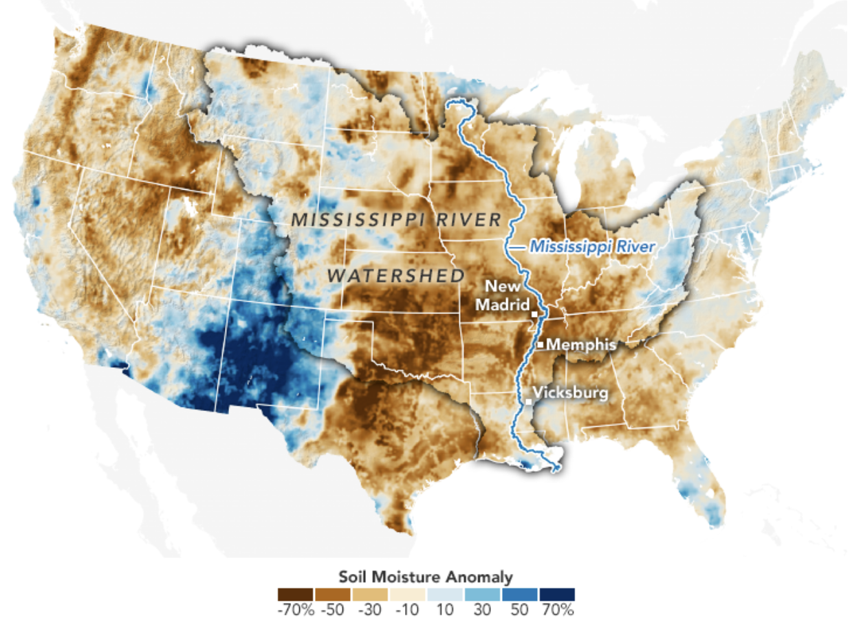
Basically, the entire Mississippi River watershed is in the midst of an historic drought. Even as eastern Kentucky is recovering from record floods, the western part of the state is so parched that the ground is cracking open.
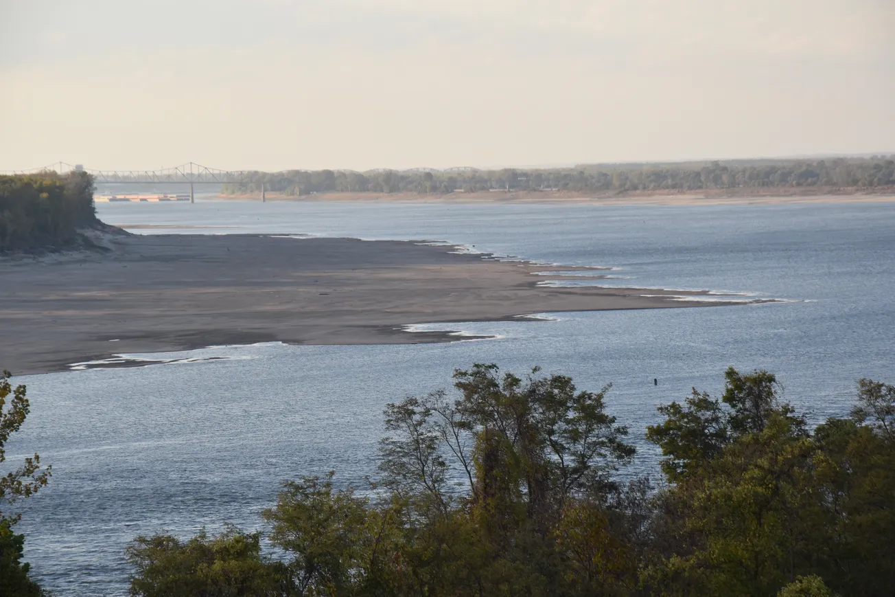
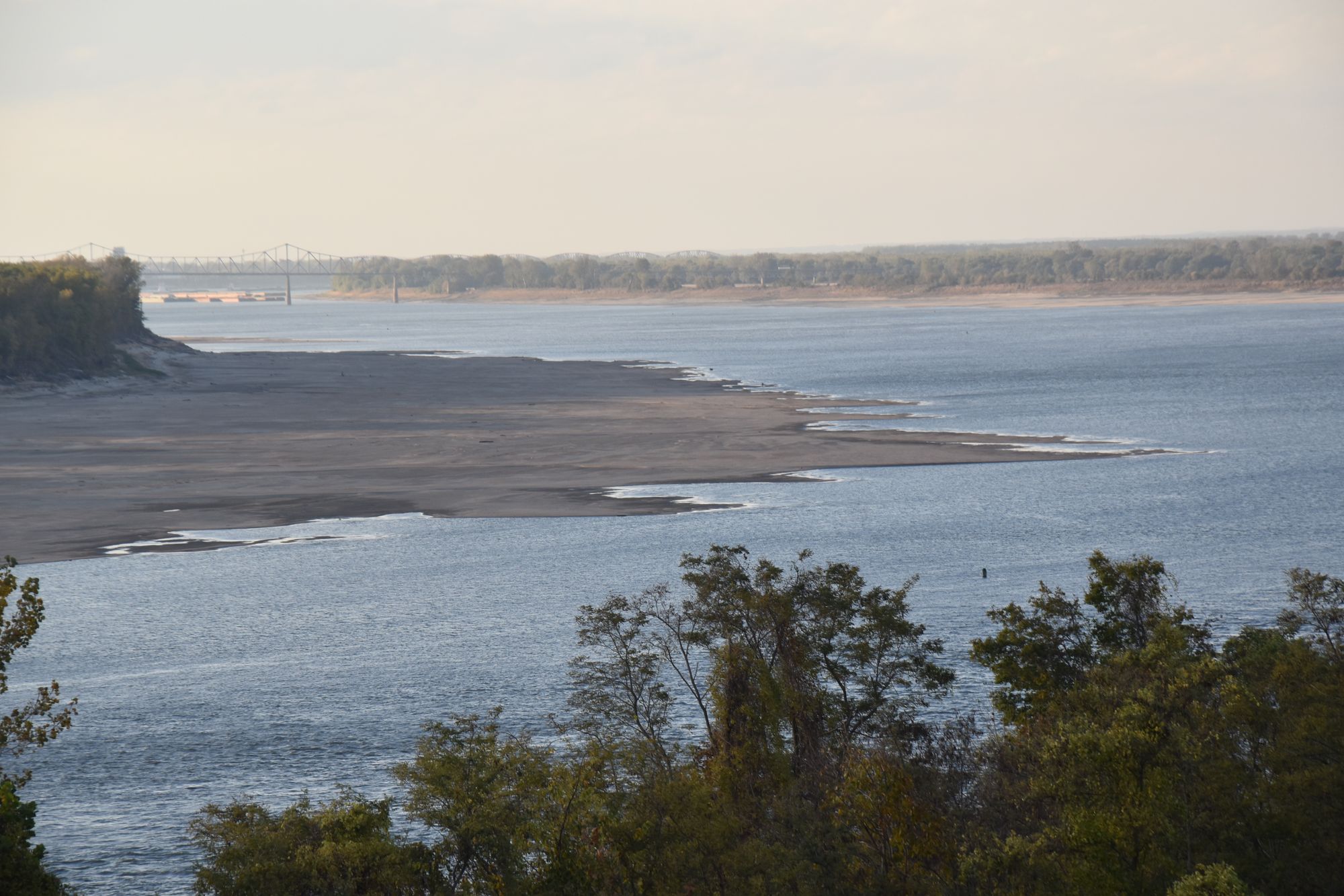
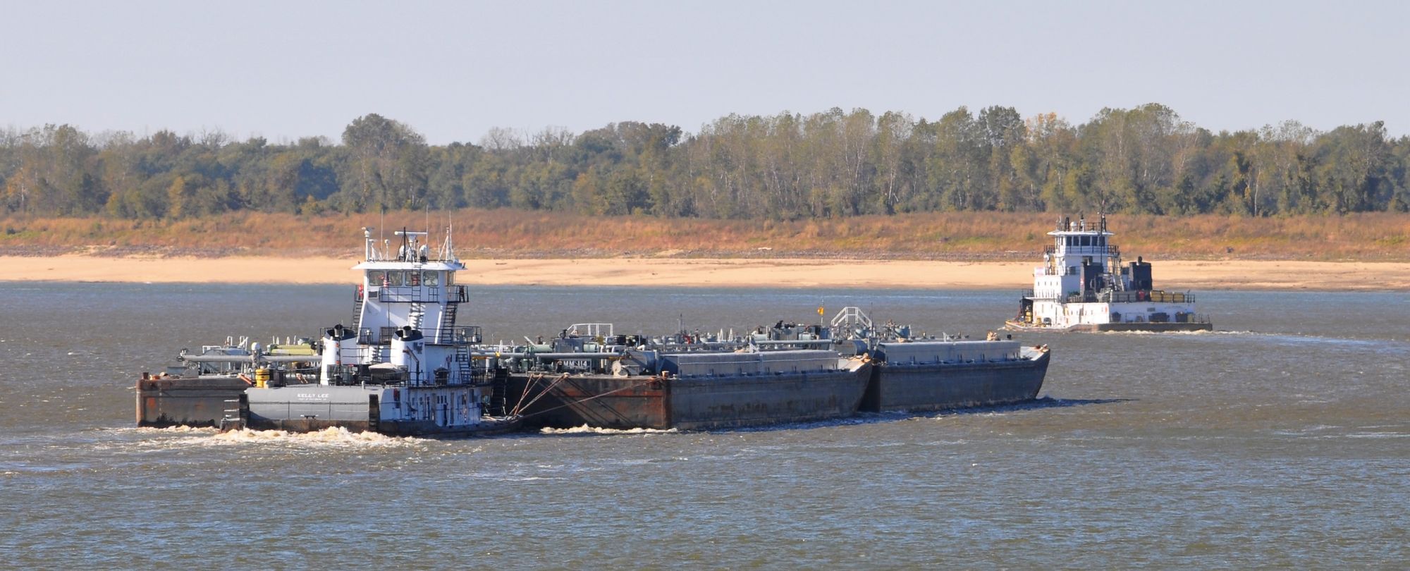
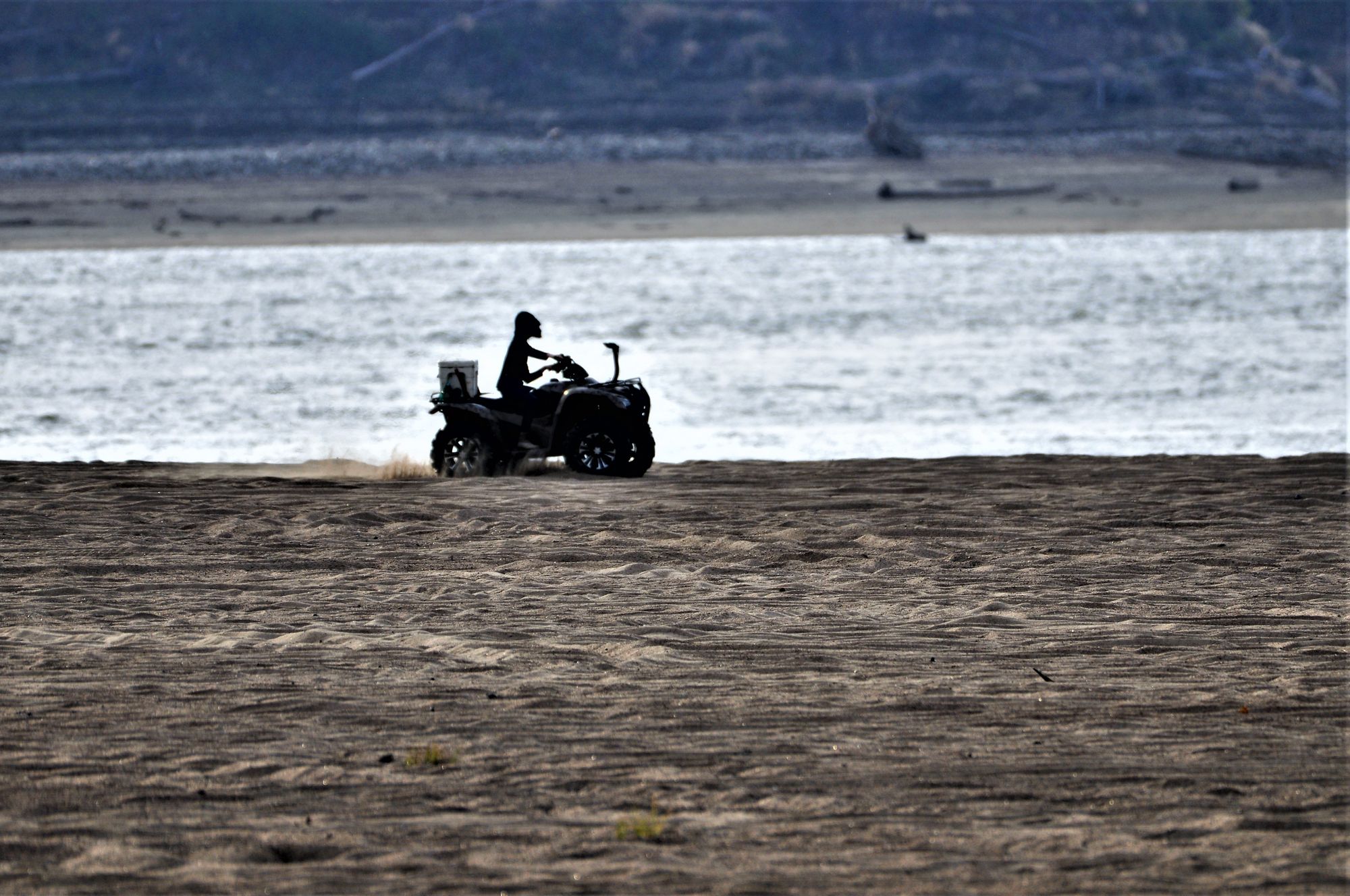
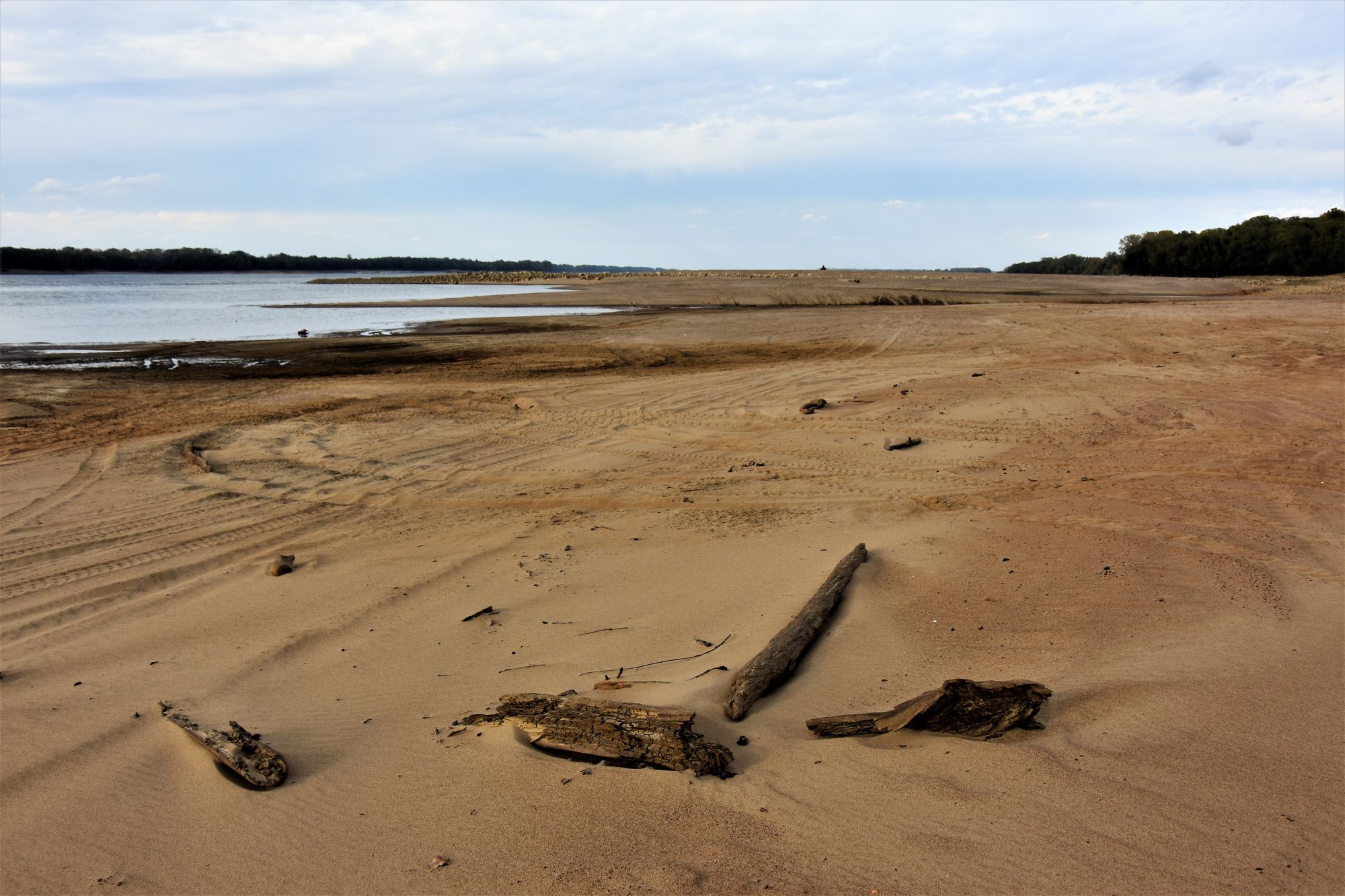
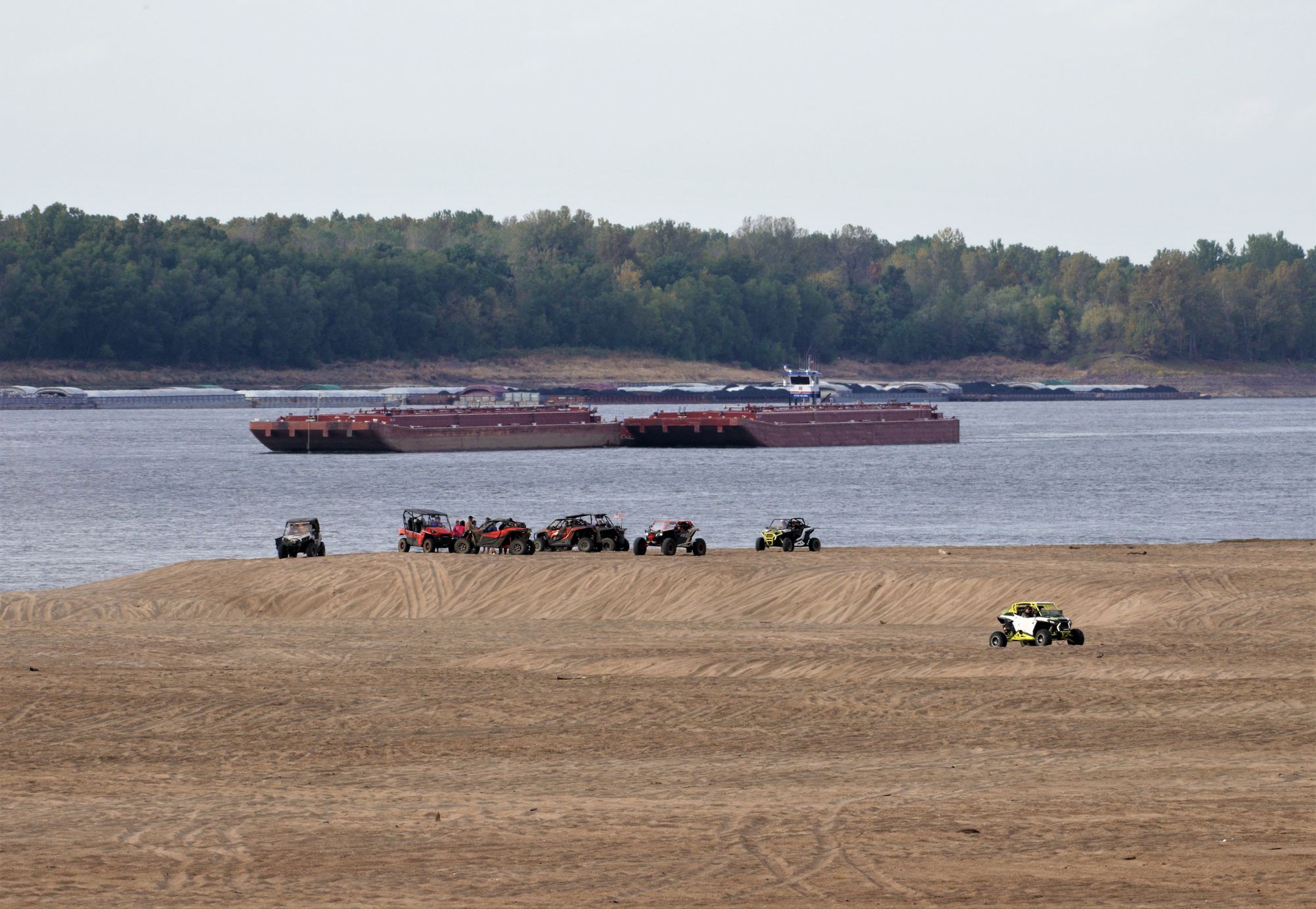
And the Mississippi River is at historically low levels. So low, in fact, that barges are having trouble making it up and down the river, and long-hidden sandbars have suddenly appeared.
Berry drove over to the river and took these pictures of the river.
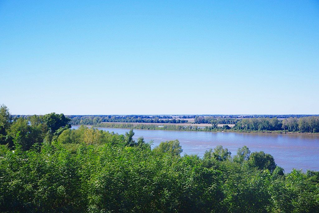
Just as a point of reference, here is what the river normally looks like at Wickliffe:
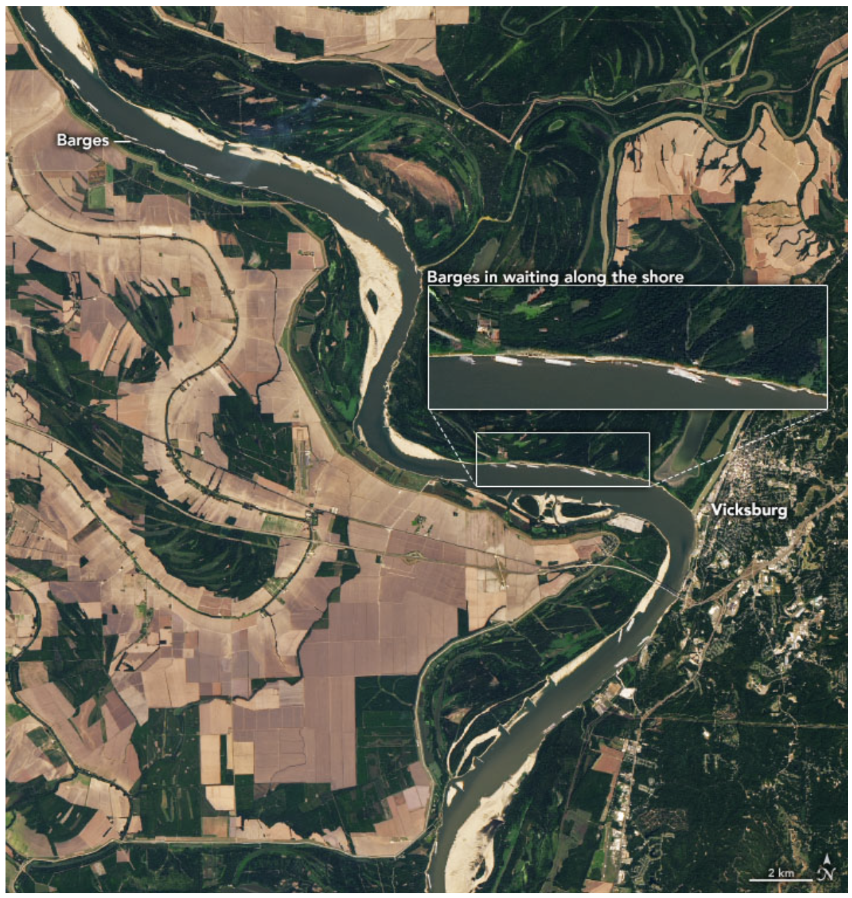
To get an idea of the impact this is having on shipping and supply chains, here is a satellite photo taken just a few days ago of the river near Vicksburg. Notice the massive expanses of sand, the narrowed channel, and the barges parked on the sides of the river, waiting for the river to rise to the point they can finally deliver their goods.
And finally, to give an even larger view, here is a map showing how bad the drought is in the middle of the country. The darker the brown, the worse the drought.
Let’s be clear: due to the fact that the earth’s climate is a system with multiple feedback loops, it is not possible to tie a single weather event directly to climate change. What IS possible is to identify trends over time – and weather anomalies like drought and floods are becoming increasingly common.
So when we talk about dealing with the climate crisis, this is what we mean – predicting weather and climate events in the future, and then figuring out what you are going to do about them. If your barges can’t make it up and down the river due to drought, and droughts and floods are going to become more common, what is your plan?
Welcome to the new reality of climate change. Better get prepared.
--30--


